Esri: The Future of Analytics Is GIS
Esri claims the future of analytics is GIS. News from the Esri User Conference 2026 on how they support that claim.
Esri’s founder Jack Dangermond claims that the future of analytics is GIS, which can be substantiated by the fact that ultimately we have to manage our sole and finite resource – the Earth. Let’s see what news Esri User Conference 2026 has delivered to support this claim.
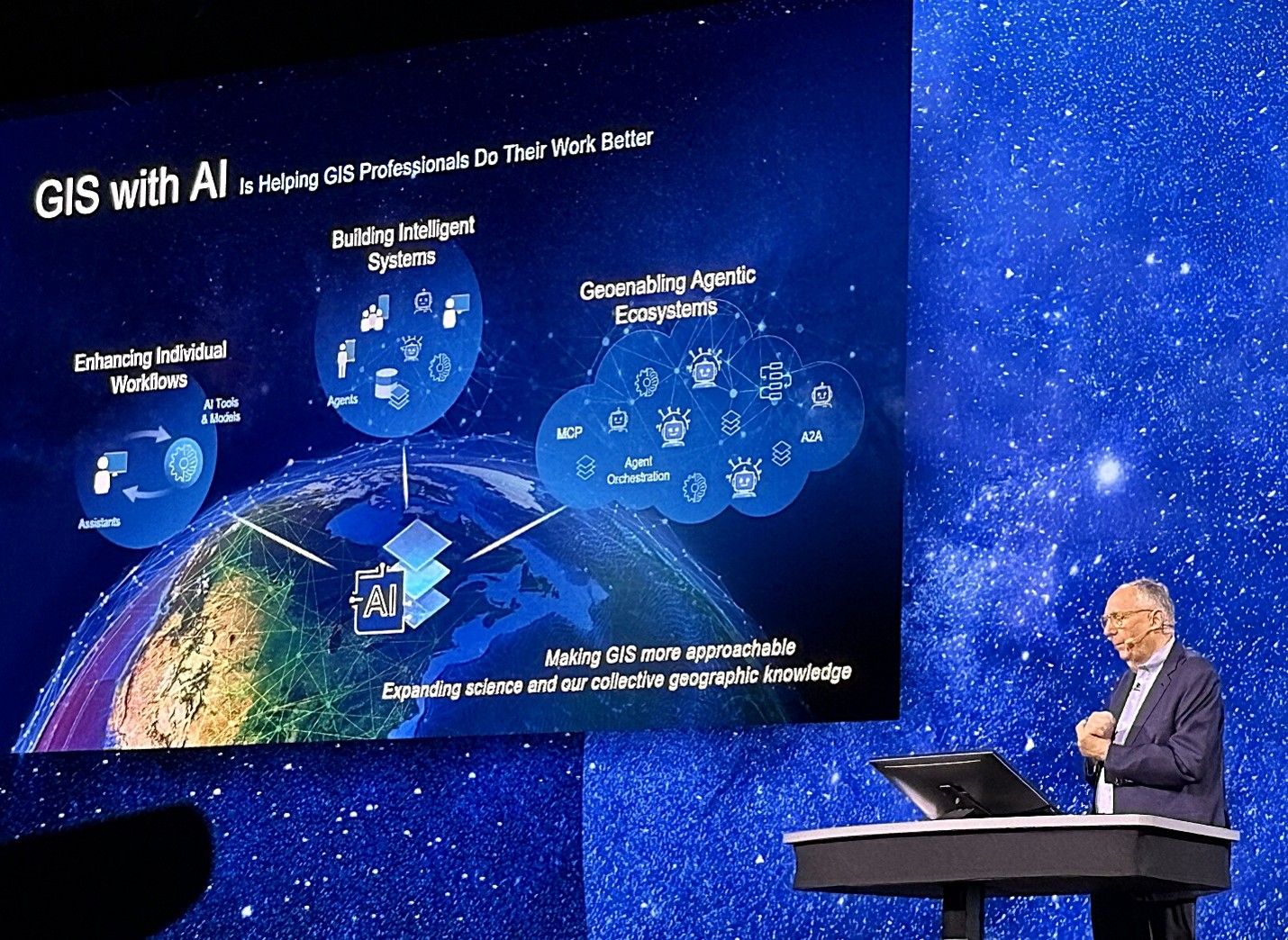
Picture: Igor Ikonnikov; Image Esri
ArcGIS has become the dominant platform for Geospatial Analytics. It’s a staple tool for any organization planning and analyzing operations anchored to geo locations – governments of all levels, utilities, oil and gas, transportation, agriculture, environment management, property management industries – just to name a few. Budget-stripped government agencies and municipalities are even using ArcGIS as their main data integration, reporting, and analytics tool, which probably prompted Esri to claim that ArcGIS cold be an enterprise data consolidation, integration, reporting, and analytics platform. Let’s see what the 2026 conference announcements had to support this claim:
- Support for all types of data – an excellent starting point, especially because it is supported by a common semantic layer comprising ontologies and knowledge graphs
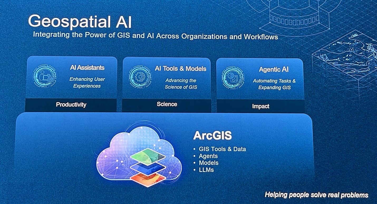
- Availability of different types of AI applications – AI assistants (productivity), AI tools & models (science), and agentic AI (impact)
- Enablement of various types of analytical activities – feature, raster & graph analysis, spatial statistics & machine learning, data exploration & engineering, modeling & scripting
- Real-time processing of sensory & dynamic data with auto-refreshing dashboards (ArcGIS Velocity for ArcGIS Enterprise)
- Browser-based editing and access to reports via mobile devices
- Support for MCP (beta) for geocoding, routing, elevation, and static maps
- Stronger 3D and “living digital twin” capabilities
- Geospatial foundation models: Global Location Encoder models, GeoVLM (geospatial vision-language model), remote-sensing foundation models
- ArcGIS for ServiceNow – a new bidirectional integration connecting the two platforms
- Data Pipelines (GA) for no-code data ingestion, transformation, scheduling, and publication
- Spatially optimized Parquet feature layers (in beta)
- Review map to analyze web maps for performance and resilience under high demand
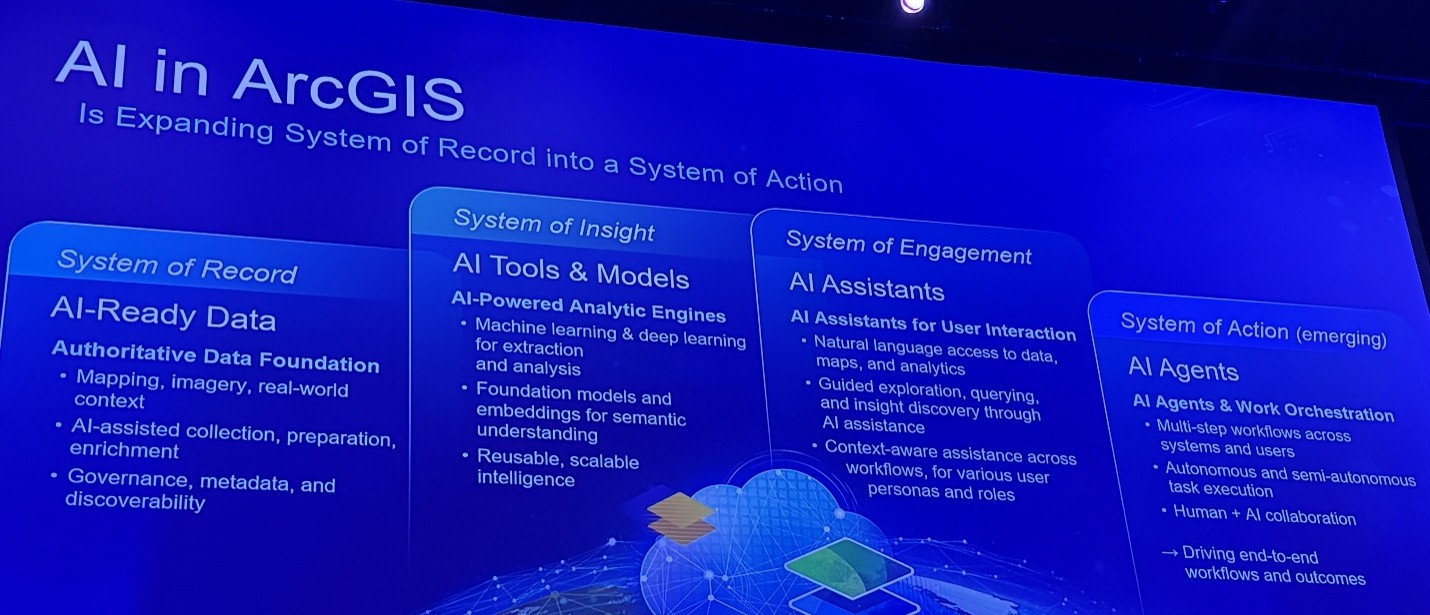
Esri claims that AI in ArcGIS expands “System of Record into a System of Action”:
Picture: Igor Ikonnikov; Image content: Esri
Being a system of record sounds like a powerful claim, but it would be more accurate to refer to it as a spatial system of record. ArcGIS is unique in that it enables more comprehensive and accurate decision-making since it can host and process various types of data – structured, unstructured, spatial, etc. – but its strength comes from its ability to analyze, store, and manage geographic data. It does allow users meet GDPR and HIPAA standards, as well as incorporating data integrity rules, data store registration, role-based access, and administrative controls that dictate how their data is stored, accessed and shared. Admittedly, a typical system of record usually requires a strictly controlled framework of record management with well-defined governance controls, including records immutability, change management, lifecycle management, and data quality management.
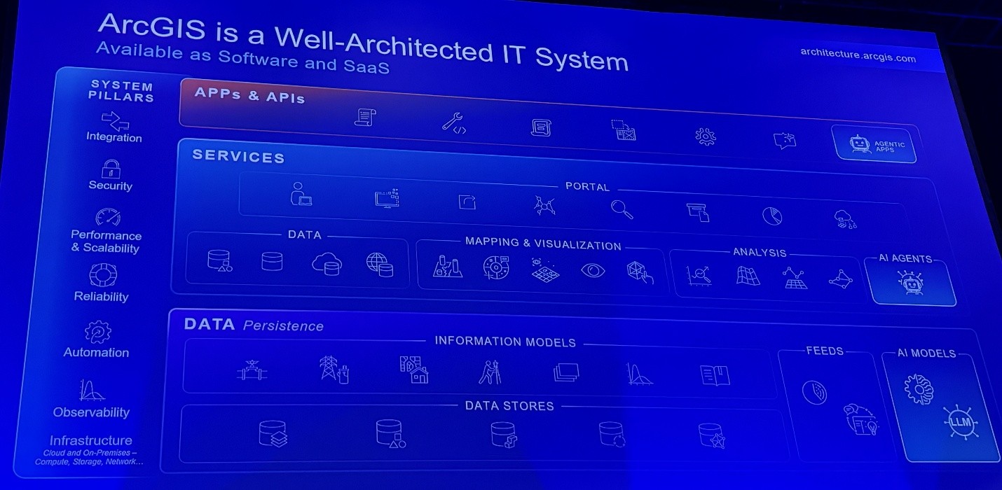
ArcGIS seems to be a “well-architected IT system” with three core layers – data, services, and apps – supported by seven pillars: Infrastructure, Observability, Automation, Reliability, Performance & Scalability, Security, and Integration.
Picture: Igor Ikonnikov; Image content: Esri
As per Esri, the geographic approach for GIS and AI is becoming an AI operating model for the real world – mainly because this approach provides richer context and solid geo anchoring. Omni-permeative use of Knowledge Graph tremendously enhances AI accuracy and grounding. Yet, with all due respect for GIS, we have to admit that analytics and AI include use cases very insignificantly, if at all, dependent on GIS, and might require different technological capabilities.
Our Take
Data management practitioners might have already noticed the lack of data quality and master data management capabilities – quintessential for a centralized data and analytics platform that is supposed to integrate data from various source systems, business units, and geo locations. Esri’s users are smart and industrious – they compensate for this gap with their own scripts/solutions – but from the platform completeness assessment it still remains a gap.
Picture: Igor Ikonnikov; Image content: Esri
Esri’s adherence to Semantic Web standards in their Semantic Integration Layer is highly commendable as it ensures portability and ease of integration with other products using these standards. What seems to be missing is the editor for RDF/OWL-based ontologies and knowledge graphs.
Overall, it’s a great tool for reporting and analytics – indispensable for GIS-grounded analytics. Esri’s Product Managers are very attentive to customer needs, and the conference has proven that by the abundance of updates. However, it still misses some core data management capabilities required to become the centralized and unified enterprise analytics platform Esri aspires to become.
